


Post-Disaster Recovery Platform
About
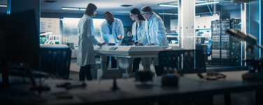
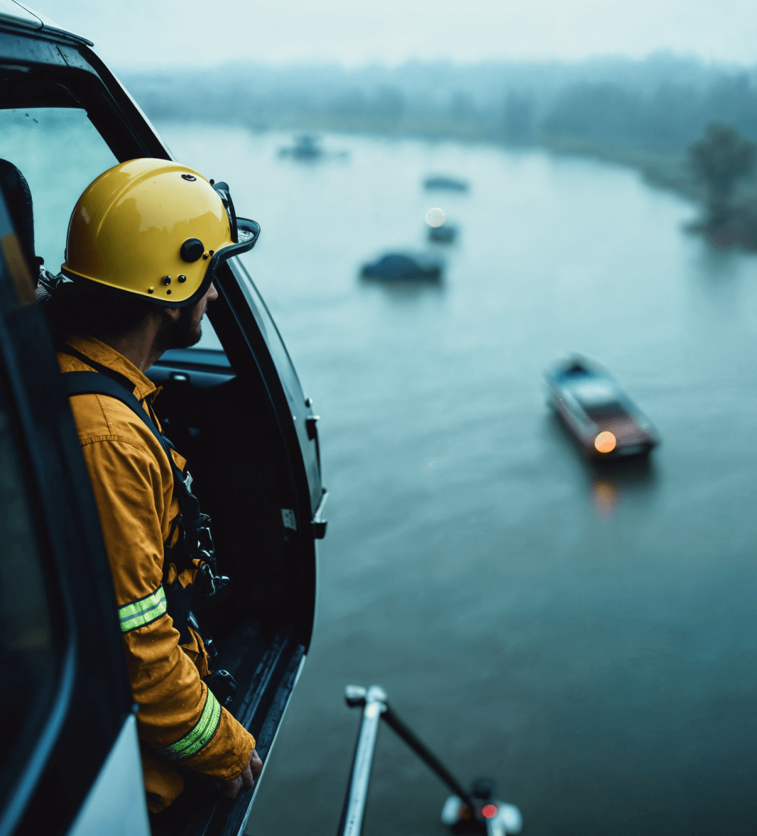
A US-based marine response and infrastructure operator needed a centralized digital platform to support large-scale disaster response and recovery operations. The organization draws on long‑standing expertise in marine recovery and environmental protection. When natural disasters strike, they're deployed to high-risk environments where quick decisions are critical.
The company manages large volumes of field data related to sunken vessels, marine debris, environmental hazards, damaged infrastructure, and restricted access zones. Multiple teams collect this data across different locations, often alongside external agencies. As a result, aligning efforts, setting priorities, and making informed decisions becomes increasingly difficult when time is critical.
To address these challenges, the organization set out to implement an AI-enabled platform designed to bring geospatial information into a single operational view. The platform needed to support real-time visibility and translate incoming data into clear, actionable insights both before and after disaster events. The ultimate objective was to speed up impact assessments and improve coordination across response teams. It would also enable more effective planning for recovery and restoration work.
Challenge
Bringing AI into real disaster response is far from simple. The technology has to overcome operational hurdles, technical limitations, and even organizational resistance before it can deliver reliable results under pressure.
- System integration complexity. The solution needed to work alongside existing emergency response systems and tools, without disrupting how teams already operate during active incidents.
- Data consolidation at scale. The system had to bring together data from many sources (satellite imagery, field observations, and infrastructure records) and present it in a single, usable view for response teams.
- Adoption in time-critical scenarios. The platform needed to be easy to use for different roles in high-pressure situations, without relying on long training or complex onboarding.
- Multi-layered role management. The solution had to support different user roles, from field crews to analysts and coordinating agencies, with clear access levels and responsibilities.
- Operational reliability. The system needed to provide stable and dependable assessments that teams could trust when making real-time response and recovery decisions.
Solution
Softarex developed a Proof of Concept software platform designed to support natural disaster response and recovery through AI-driven geospatial analysis. The system focused on accelerating post-disaster assessment by detecting impacted objects and areas and transforming raw imagery into actionable operational intelligence.
The solution was designed as a modular, scalable platform:
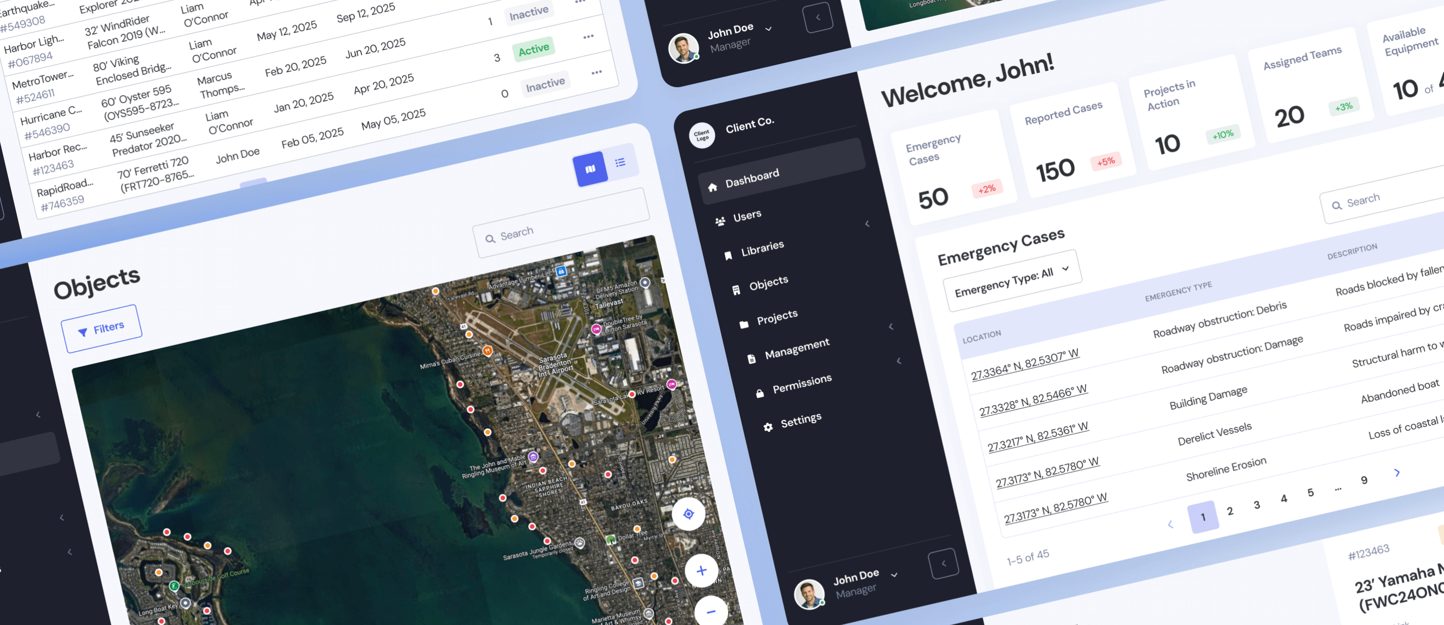
- Centralized disaster management portal. The platform consolidated pre- and post-disaster data related to derelict vessels, roadblocks, damaged buildings, and infrastructure issues into a single administrative interface. This enabled teams to monitor affected areas, prioritize actions, and coordinate response efforts more efficiently.
- Pre- and post-event data comparison. The workflow incorporated satellite imagery and aerial video collected before and after storm events. By comparing these datasets, the system identified changes in the environment and highlighted disaster-related impacts.
- AI-powered object detection. Computer vision models analyzed imagery to detect derelict vessels displaced by storms, including those washed ashore or displaced from boatyards. Detection logic leveraged geospatial context, shoreline changes, and erosion indicators to distinguish derelict and non-derelict objects.
- Automated dimension analysis. Trained AI models estimated vessel dimensions using imagery resolution and camera parameters. This enabled early assessment of removal complexity, equipment needs, and remediation costs.
- Geospatial tagging and visualization. Detected objects were tagged with precise geographic coordinates and visual overlays, providing clear situational awareness across affected zones.
- Role-based access and workflows. The admin portal supported multi-level user roles, enabling field teams, analysts, and decision-makers to access relevant data, review findings, and contribute feedback without disrupting operations.
- Scalable architecture. While the PoC initially focused on a single geographic area and object type, the system architecture was designed to scale. It supports future expansion across regions and additional object categories, including roadway obstructions, building damage, marine infrastructure, and shoreline erosion.
Project results
- The Softarex team developed a PoC that improved mitigation plan development and enabled more efficient coordination across agencies by consolidating disaster data into a single analytical view.
- The platform supported optimized response prioritization by highlighting high-risk objects and affected areas, allowing teams to allocate resources faster and more effectively.
- Field and command teams gained effective command and control through geospatial tagging, object visualization, and role-based access to actionable insights.
- The PoC directly supported the identification and removal of sunken and derelict vessels posing environmental and navigational risks.
- The solution demonstrated the feasibility of transforming raw satellite and aerial data into structured intelligence, moving from data to information and decision-ready insights.
- The architecture supports progressive object detection growth beyond derelict vessels to include roadway debris and damage, building damage, marine infrastructure issues, fuel pumps, barges (WIP), shoreline erosion, and further refinement of vessel classification.
- The system proved suitable for use by strategic, operational, and tactical leaders, supporting mitigation planning, response execution, and on-the-ground decision-making.
Technical challenges
Get in touch with Softarex’s team
Have questions about your future project? Feel free to contact our team.